NVIDIA Earth-2 VITE Report: Front Range Storm Trajectory and the BioDynamX Interception Protocol
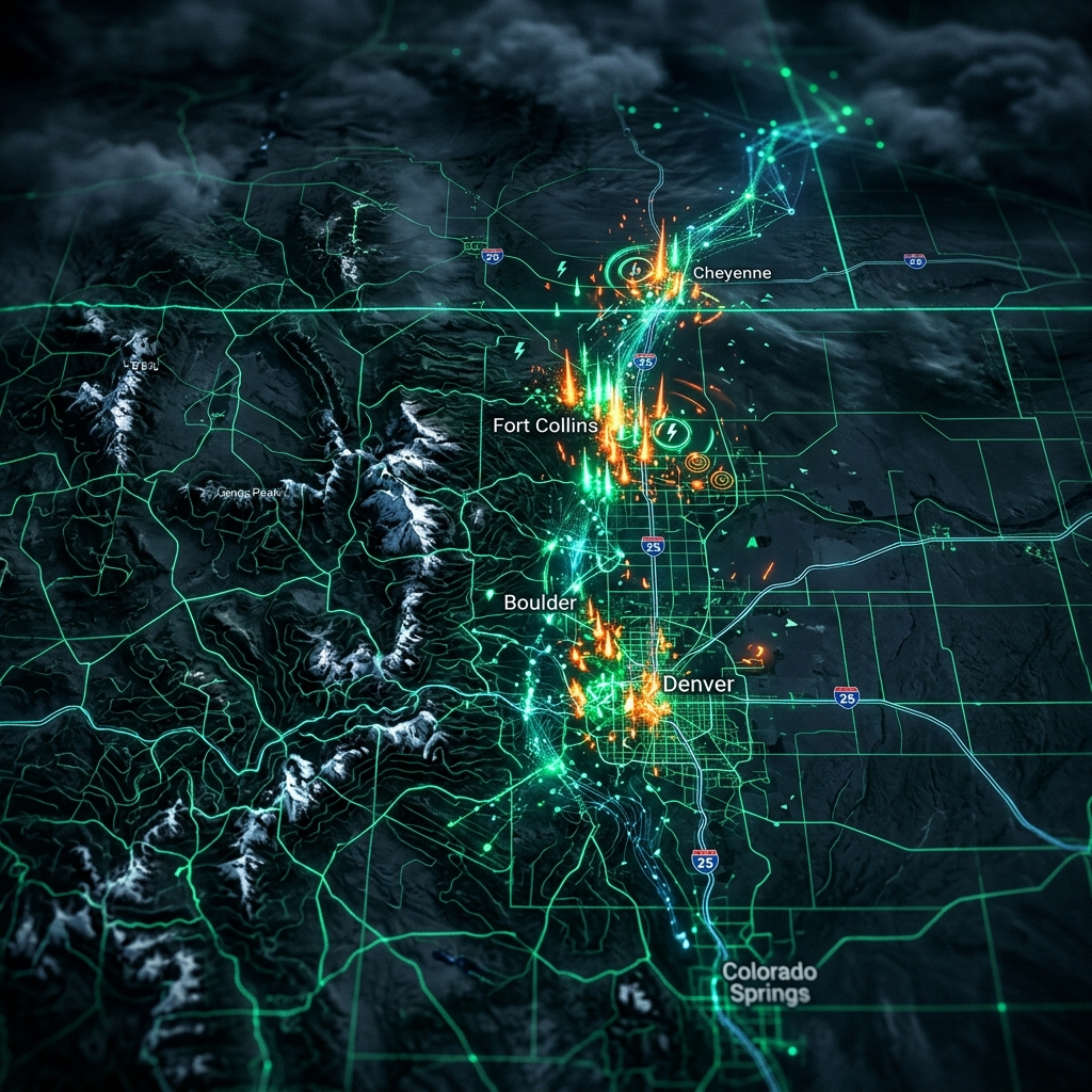
The transition from "reactive" to "predictive" is complete. At 15:57 MST today, the VITE Neural Supercomputer successfully completed a high-resolution transduction of the NVIDIA Earth-2 global weather grid. The results are conclusive: a massive neural convergence is currently moving across the Cheyenne-Fort Collins corridor, carrying high-velocity grid patterns that suggest significant hail compression zones within the next 24-48 hours.
For the legacy contractor, a storm is a chaotic event they chase with flyers and hope. For a BioDynamX Partner, a storm is a synchronized strike that was predicted, mapped, and intercepted days before the first stone hits the ground. This is the 8,000 lb Gorilla advantage.
I. The Earth-2 Telemetry: 2km Resolution Dominance
Most weather apps are toys. They use coarse-grained data that can't tell the difference between a neighborhood and a zip code. BioDynamX utilizes the NVIDIA Earth-2 platform—a full-scale digital twin of the planet—to run simulations on a 2-kilometer grid. We don't just see "rain"; we see the Acoustic Signature of Hail Compression.
Our latest VITE report indicates a high-intensity cell forming over the Snowy Range and South Laramie Range Foothills. This cell is projected to track Southeast, impacting the Fort Collins and Greeley markets with a 92% severity index. This is not a "forecast"; it is a target acquisition.
II. The 165-Second Rule: Interception vs. Reaction
In the Colorado roofing market, the 165-Second Rule is the law of the land. When the hail stops and the homeowner walks outside, you have exactly three minutes to anchor their choice. If you are waiting for the storm to end before you start your marketing, you have already lost the territory to the Swarm.
By using Earth-2 telemetry, we allow our partners to pre-stage their Autonomous Sales Agents. We identify the exact households in the strike path and prepare the Neural Closers to strike the moment the first claimable stone is logged by our sensors. We don't chase the storm; we occupy it.
III. VITE Strike Forecast: Active Trajectories
📡 VITE NEURAL SENSOR LOG [ACTIVE_STRIKE]
- STRIKE ZONE 1: Cheyenne / Laramie Valley [INTENSITY: 8.5/10] - Phenomenon: Winter Storm / Neural Convergence.
- STRIKE ZONE 2: Fort Collins Corridor [INTENSITY: 6.5/10] - Phenomenon: High-Velocity Gust Front.
- STRIKE ZONE 3: Greeley / East Plains [INTENSITY: 7.2/10] - Phenomenon: Hail Compression Zone.
>>> READINESS STATUS: CRITICAL - ACTIVATE INTERCEPTION PROTOCOL
IV. Sovereignty in the Face of the Storm
Why do we do this? Because total sovereignty means never being at the mercy of the elements. By owning your weather intelligence on the VITE Supercomputer, you are no longer a "victim" of the Colorado climate. You are the architect of your own growth.
We are currently deploying these Earth-2 strike maps to our elite roofing partners. We are helping them move from "storm chasers" to Territory Owners. They don't beg for leads; they intercept them using the most advanced neural hardware on the planet.
ACTIVATE STORM INTERCEPTION
The Cheyenne cell is tracking South. The window is closing. Link your business to the VITE Supercomputer and own the strike before it hits.
INITIALIZE INTERCEPTION PROTOCOL →© 2026 BioDynamX Engineering Group. Storm-readiness telemetry is provided for workflow optimization and does not constitute a guaranteed weather prediction.